Page 161
The following chapters quote a text, which the postmaster Kreutz wrote in the thirties. He has written a chronicle that, of course, cannot be measured by today's standards, so it has no scientific character.
It is rather a text addressed to those who are interested in the history of their homeland. It is reproduced the section „Economy, Industry, Trade“: „In the past, arable farming and livestock farming is the main occupation and the main activity of residents. In addition, other branches of the agriculture such as beekeeping plays a minor role. Due to the flourishing of industry over the last 50 years (1880 to 1930), agriculture has moved second as an activity. In earlier times, the river Wurm was important for the business. The Wurm originates in the Aachen forest and enters the Würselen area from the south through the so-called Wurmbenden.
The river powered the former two flour mills, the Wolfsfurthermühle (Later cloth factory) and the Adamsmühle, as well as six copper mills and a pumping plant of the coal mine. The importance of copper trading here is highlighted through the fact that in 1732 Würselen’s copper smiths could found a member-rich fraternity and support fund. The Nadlers also had their own brotherhood in the Würselen district. In addition to copper trading and needle manufacturing, the trade of cloth makers flourished. Also, the Würselener paver are known and sought after. Traces of the once flourishing rifle production could not be found anymore. Needle making took that place which still employs about 200 workers today.
Oldest Coal mining in Europe
The rich Mineral resources of coal was the reason why there were early mining activities in the Wurm area. Coal mining in this area is arguably the oldest in Europe. The systematic mining of coal in the Wurm district dates back to the 14th century – traceable to about 1353. In 1602 the following pits are mentioned in the Würselen area: Schluffert in Scherberg, the Good Ley (which means pit Gouley) and „Gesellen des stoinen Crütz“.
Under the laws of that time, the owner of the land under which the coal was found was considered the owner of the coals. If the landowner gave the right of mining to another, this one had to pay compensation, the so-called Erbpfennig, i.e. a certain percentile rate of gross income. The law of sovereignty of coal mining in Würselen and Morsbach had the city of Aachen, which granted permission for the yield and a fee for it - the so-called Maipacht.
Coal production using the simple means known at the time was tedious and costly.
The coal transportation was done in baskets by the help of horse powered coilers. The dry burning coal was brought in bags on horses all the way to Düren, Eupen and Monschau. Leader and horse were named „Kohlegidse“. In the 18th century, capital began to stand up for the coal mining. The small businesses disappeared. With the help of capital and steam power, the pits blossomed. In 1805, the families Wültgens and Englerth in Eschweiler bought the entire mining in the Wurm valley district. They transformed the mines in 1834 into a public company - The Eschweiler Mine Association – This ssossiation still owns almost all of the coal mining in the Wurm district. From the small beginnings of a family foundation, the Eschweiler Mine Association developed purely by tough, energetic and far-sighted work by its founders into one of the largest industrial enterprises in the Rhineland, through which of the 195,000 inhabitants of the district of Aachen have about 42,000 jobs and bread. Würselen took part with around 10,000 men.
Cigars made in Würselen
Cigar production also developed well. A large number of the inhabitants found work and bread in the cigar factories in Würselen and Aachen. Alone the two largest cigar factories in Würselen – Brothers Philips and Schnorrenberg – employed 300 workers before the World Wars. Unfortunately, this has changed. The plant Schnorrenberg has been completely shut down; Philips has little significance. By losing the counties of Eupen and Malmedy, the works lost a large part of the clientele. The worsening of the economic situation that began after the war and brought complete stagnation. Now there are only smaller farms. A mock bloom revived around 1920. About 200 smaller and smallest plants opened up again, but they had a short lifespan and almost all of them are given up.
Germany's first Ammoniaksodafabrik
The Honigmann Chemical Factory, founded in 1871, is of great importance for the working life in Würselen. The factory employed more than 500 before the war. The company was sold to Deutsche Solvaywerke AG in Bernburg in 1912 for 17 million marks. The purchase is supposed to eliminate the uncomfortable competition of the work. The company continued until 1930 with 200 workers. Then the factory was closed due to „Poor economic situation and lack of a waterway“. In particular, the absence of the waterway has led to the decommissioning, because the production of raw materials compared to the situation in other plants was too costly. At no time there was a lack of sales. The products of the company in Würselen always found plenty of customers because of their good quality. After the decommissioning, the company accordingly developed their other plant where water and raw materials were present or nearby. Nevertheless, the company compensated the breadless workers in an exemplary way.
Now the extensive factory facilities and the tall fireplaces have been laid down. The once flourishing industrial complex left widely visible white cinder mountains in the city of Würselen.
Economic crisis
In 1929 and 1930, the deterioration of the economic situation, which had already begun, was felt most sensitive. The number of unemployed increased continuously also driven by the decline of factories in Aachen. Aachen always employed 1.800 Würselener worker. The Gouley pit must operate 2 to 3 idle shifts a month. The repeated reduction of wages and salaries also had an unfavourable effect on purchasing power, so trade and commerce declined sharply.” That the report of Postmaster Kreutz so far. Though we know today that coal mining can be traced back to the 12th century, one can still assume that the other information the chronicler gave is accurate.
Page 166 - lower picture
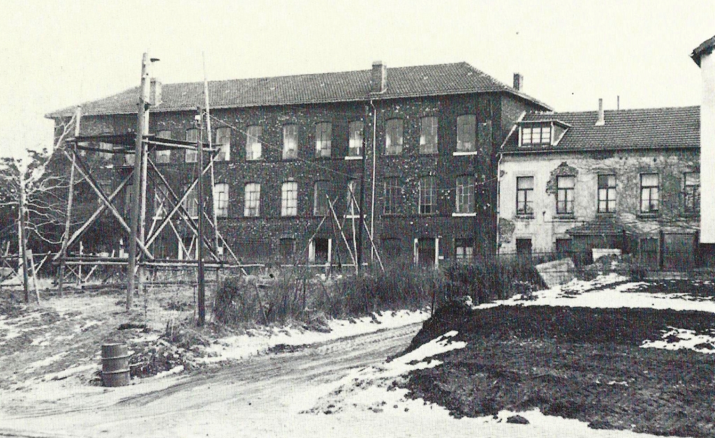
1969, just before the demolition: Cigar factory Bischoff (formerly Philips) at the Haaler Straße.
Page 167
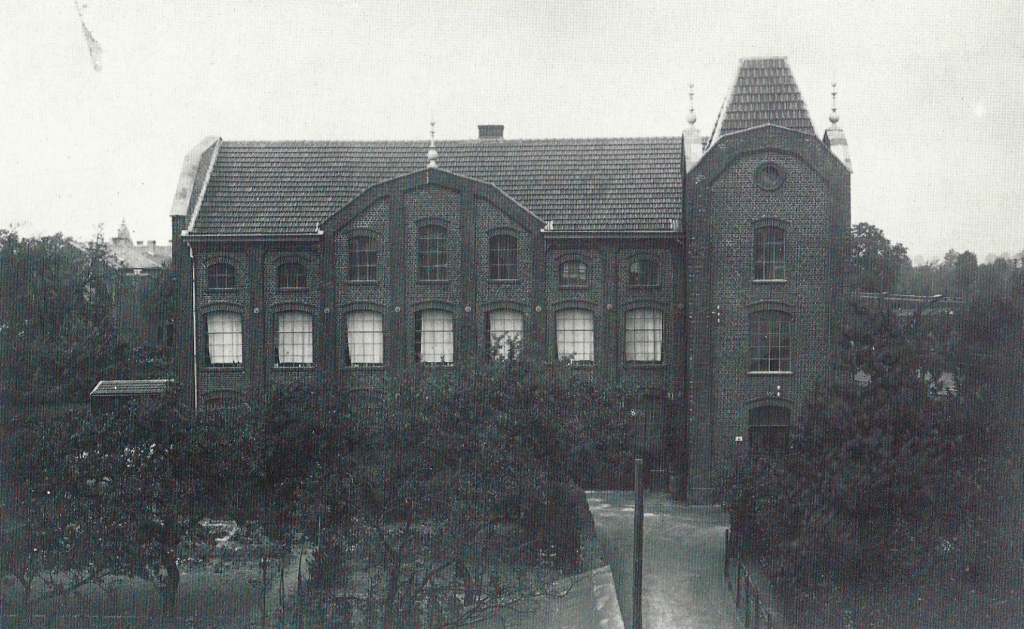
This building does not exist either any more: Former cigar factory W. Schopen at the Bahnhofstraße (1921).
Page 168 -
Map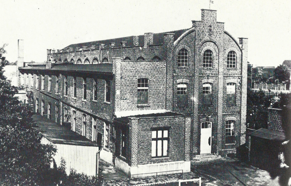
Factory Singer 1935 (formerly the cigar factory Zimmermann).
Page 170
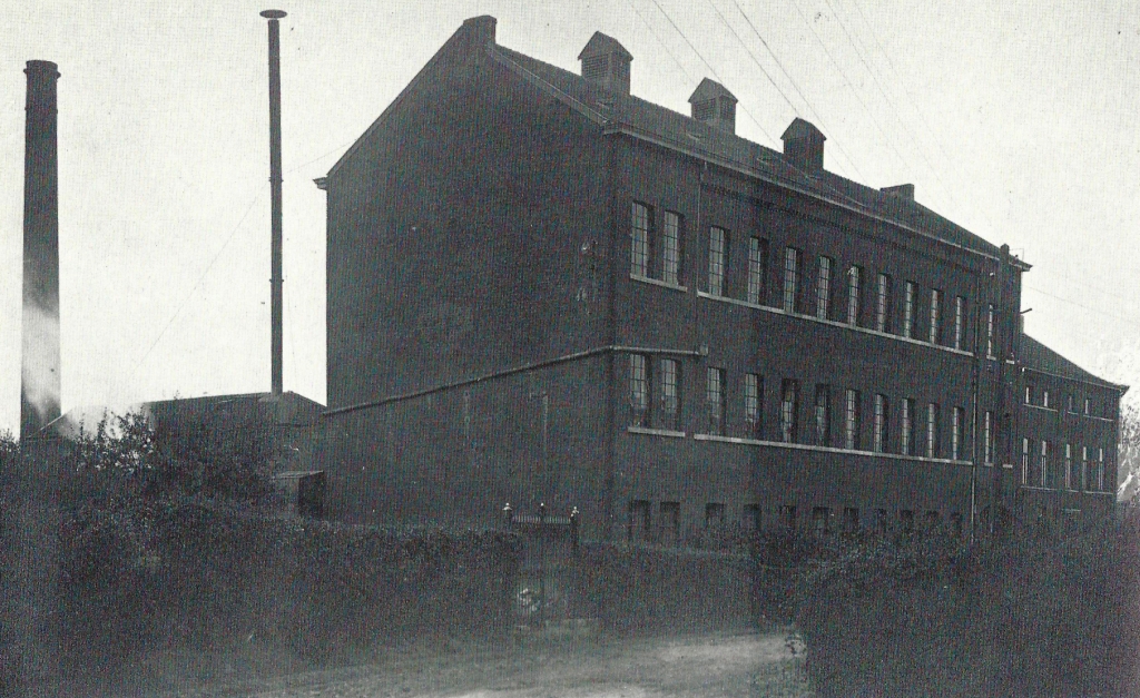
The former needle factory Gebr. Queck, founded in 1872, in its structural state in 1921.
Page 173 -
Map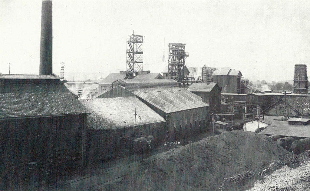
In 1871, the Honigmann Chemical Factory was founded, the first German ammonia soda factory, which later employed up to 500 workers. In 1912, the company was sold to Deutsche Solvaywerke AG. In 1928/1929, up to 200 workers and employees still found employment there; then and the company was shut down.
To this day, residues of this industry are stored near Teuterhof in the Wurm Valley and in the city centre on the right and left of the Elchenrather Straße. The picture shows the situation around 1920.
Page 174 -
Map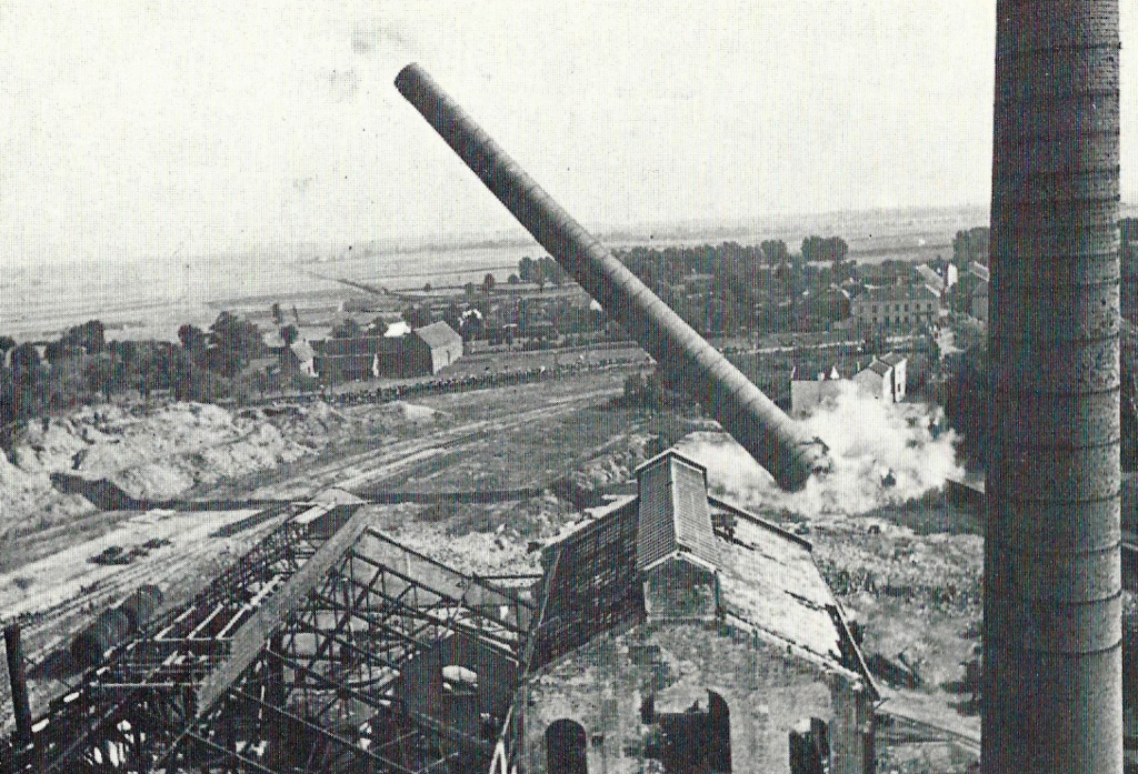
In 1935, the Solvaywerke, eventually demolished and the chimneys blown up.
Page 177 -
Map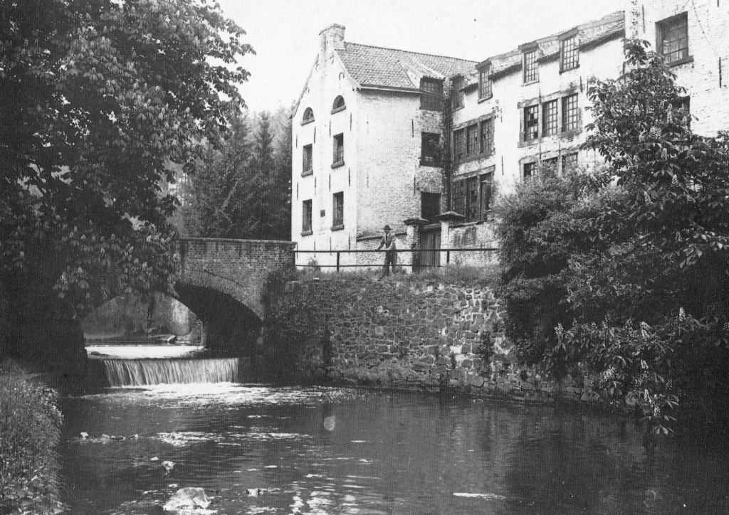
Cloth factory Wolfsfurth. After more than 100 years of production, it ceased operations in 1927.
Page 181 - top -
Map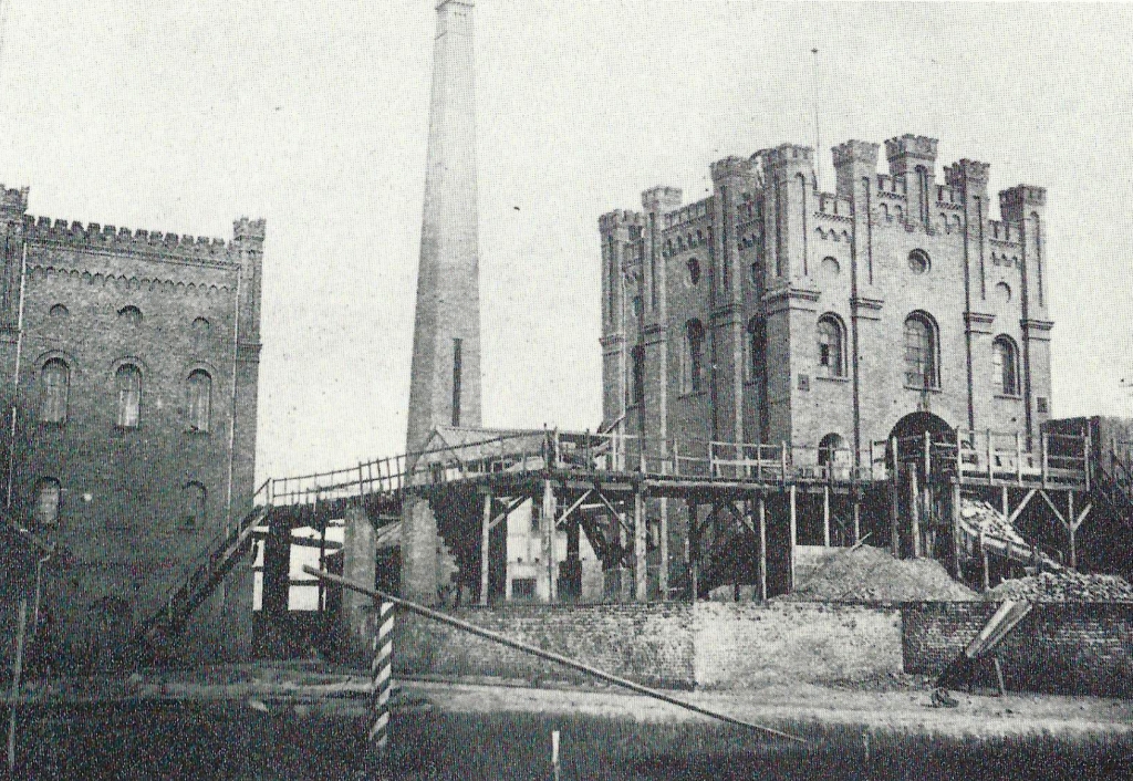
The Teut mine field received a new concession in 1851. The pit “Neue Teut” was built about at the current intersection Teutstraße/Martin-Luther-King Straße. The photo shows the ‘Neue Teut’ in 1880.
Page 181 - bottom - The factory Recker does not exist anymore. Today there is a shopping mall. -
Map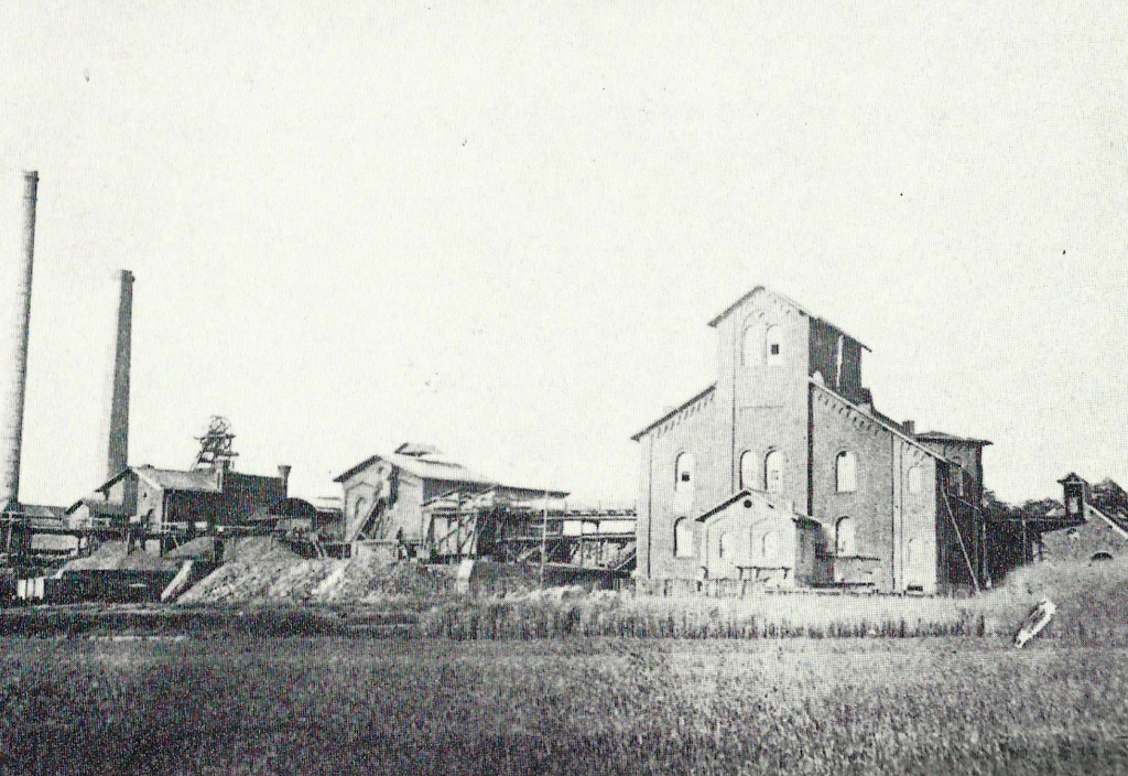
On The terrain of Reckerwerke today the Stolberg Freiherr von der Goltz built the Königsgrube in 1840/1841, which was shut down in 1852 - already in other possession. In 1864, the company resumed the operation. The picture shows the pit 1880. Later, the fields of the Würselener Pits were further mined from Gouley.
Page 183
Map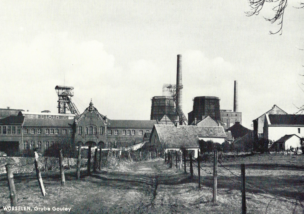
View of the colliery house and the entire complex of the Gouley mine. This photo was taken at a photography competition of the city of Würselen in 1958, also 11 Years before the colliery closed.
Page 184
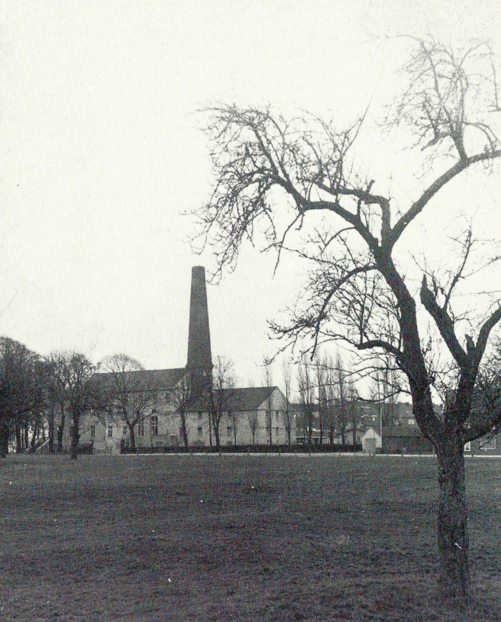
The old casino in Morsbach (phot taken 1970) offered mates a home for a long time. The building was eventually to become a youth centre, but the poor structural condition made the demolition necessary.
Page 186 - oben -
Map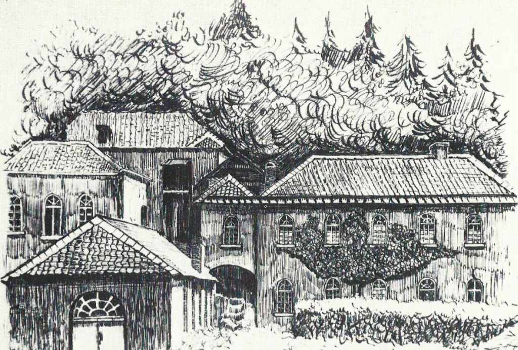
Grube Furth
Page 186 - unten - Grube Furth -
Map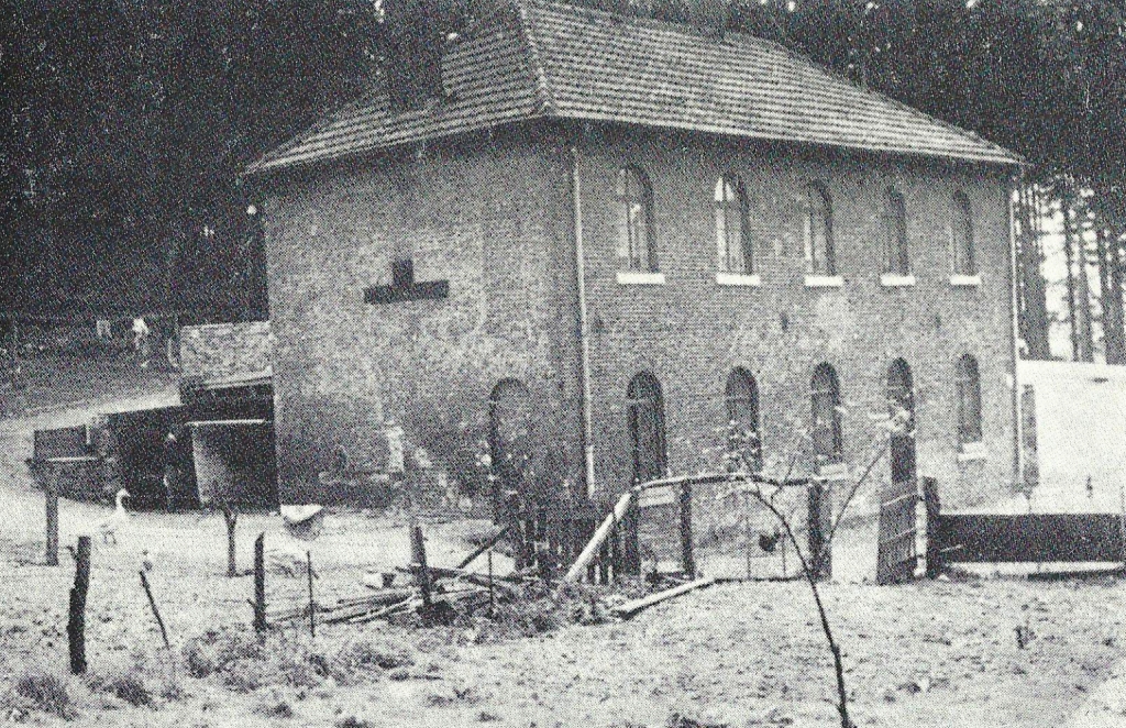
Bardenberg was a center of coal mining in the Wurm area for some time. The Miners Association based here, also the ‘Bergschule’ and the Miners Association Hospital.
One of several pits was the Furth mine, which was granted mining law in 1769. The Furth mine was closed in 1883.
This pit was famous for the art of driving. This, powered by a water wheel and transmission poles via an art cross built into the building into a vertical direction. This allowed the entrance and exit of the miners. The anchoring point of the art cross at the house is on the photo below. It is clearly visible (in the pediment).
Page 187
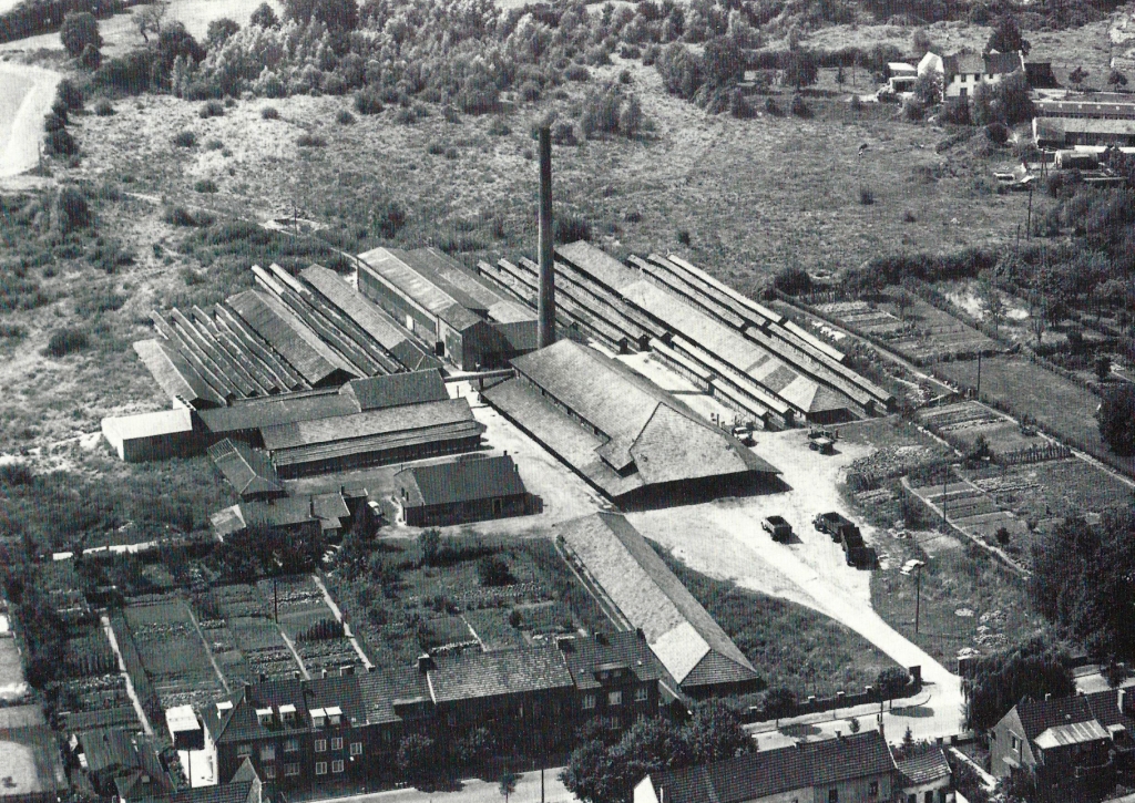
The “brick plant” Rahser is already on the city map of 1905, on the Oppener Straße. Historical scientists do not rule out that already in Roman times this craft was present in Würselen. The name „Kaninsberg“ will be derived from the Latin word ‘caminus’ which can be translated into furnace, or fire site. What remains is the name “Rahser” for a new residential area next to the Oppener Straße where in 1961 the brickworks were demolished. The citizens of Oppen later on founded a carnival club, which they call “Sejjelbäcker” (brick baker word by word). Therefore, an old profession in Würselen will stay alive in a club name.
Page 190 -
Map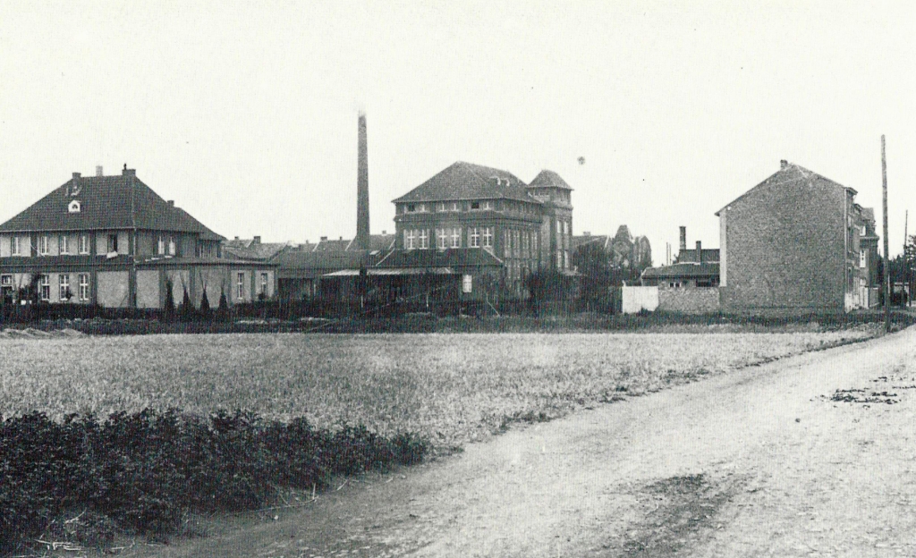
Economic building of the consumer association ‘Konsumverein Eintracht’ on Friedrichstraße in the year 1921.
Page 193 -
Map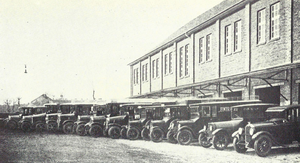
The ‘Konsumverein Eintracht’ had an impressive fleet of vehicles (around 1930).
Page 194 - heute Sägewerk Eigelshoven - Das Gebäude der Mühle wurde 2011 gesprengt. -
Map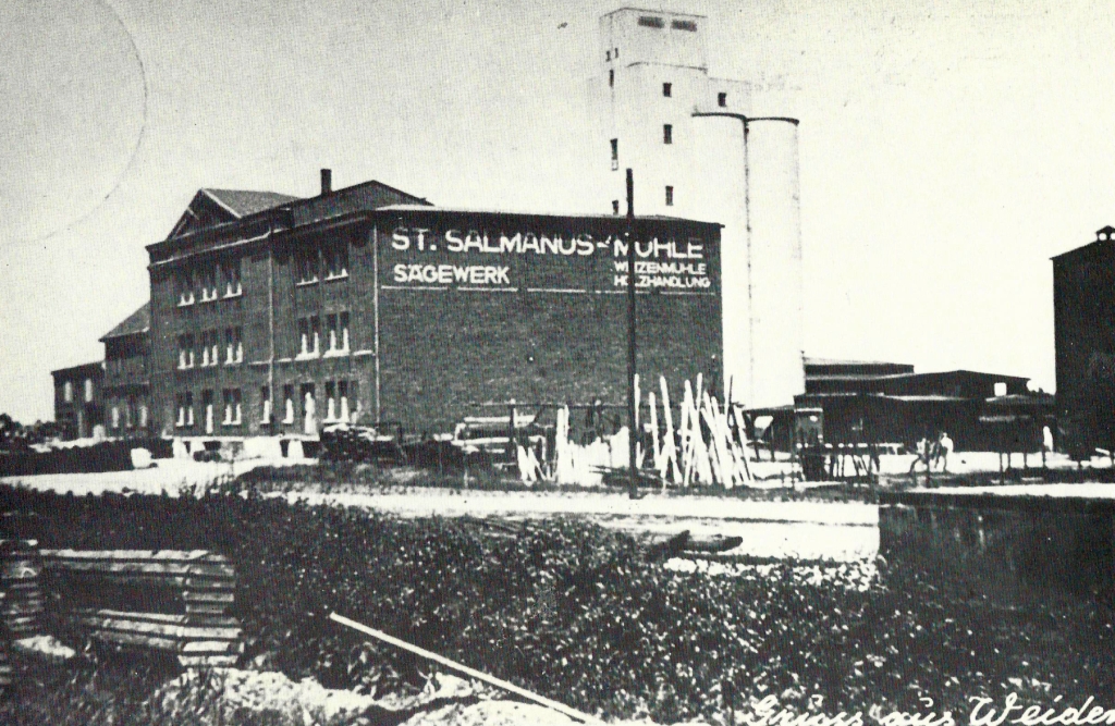
St Salmanusmühle around 1939. The feed silo was built immediately before the war began.
Page 197 -
Map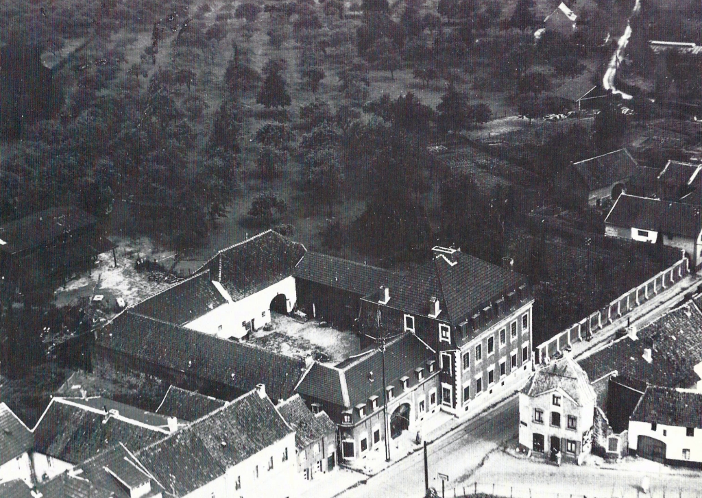
This aerial photo from 1938 shows the house and the courtyard Delahaye, built in 1775, with the associated yard and fruit meadows.
Page 199
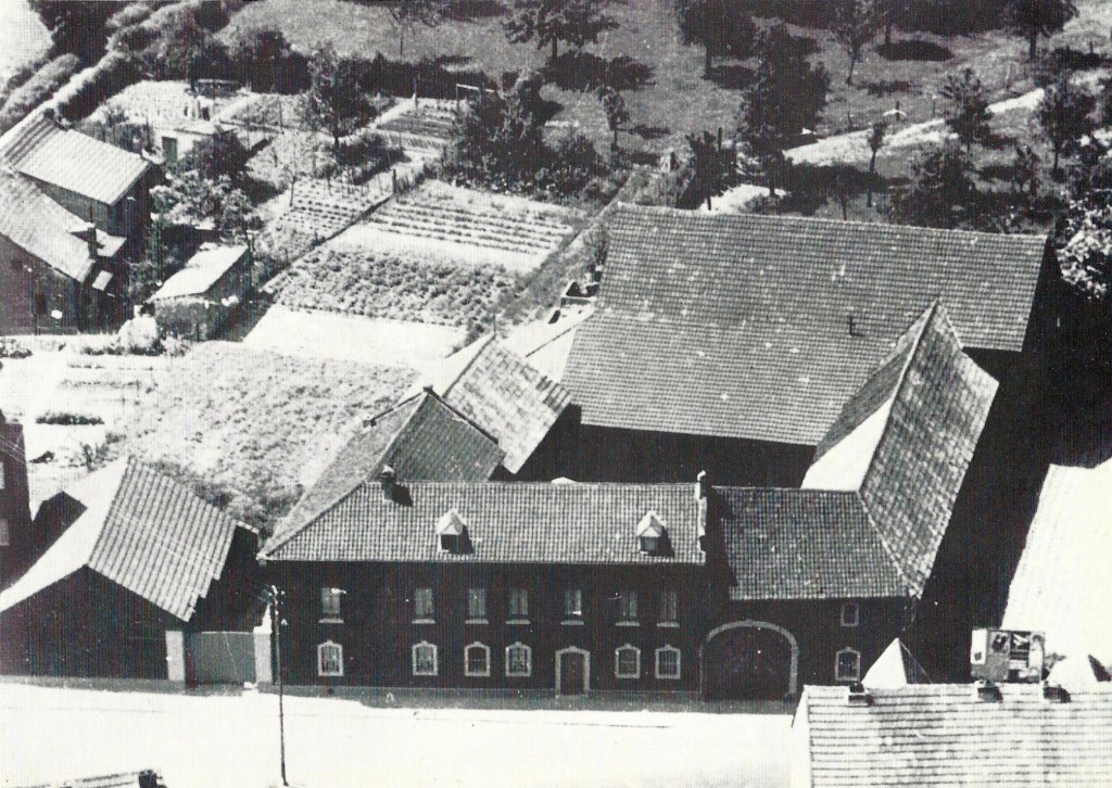
Farm Willms in Vorweiden, built in 1773 as ‘Quember-Hof‘, the picture also dates back to time before World War II.
Page 200 - Landeplatz Merzbrück -
Map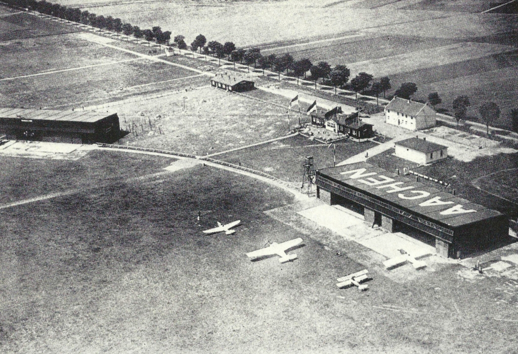
Laid out as a field airport during World War I. After the end of the war the Belgian army built a military airport at Merzbrück.
On June 29, 1930 the Germans operated the airfield again. The picture shows Merzbrück Before World War II.

