


")

Introduction
This page provides altitude profiles along three lines through Würselen. Though the maps are scaled in the same way as the other maps in the chapter they may differ a little bit because the city limits are not always visible. The graph on the top of each map indicates the profile along the red line in map. The starting point is at the marker which refers to 0 m in the graph.
The profiles were compiled using the Geopartal of Northrhine-Westfalia.
Profile southwest to northeast
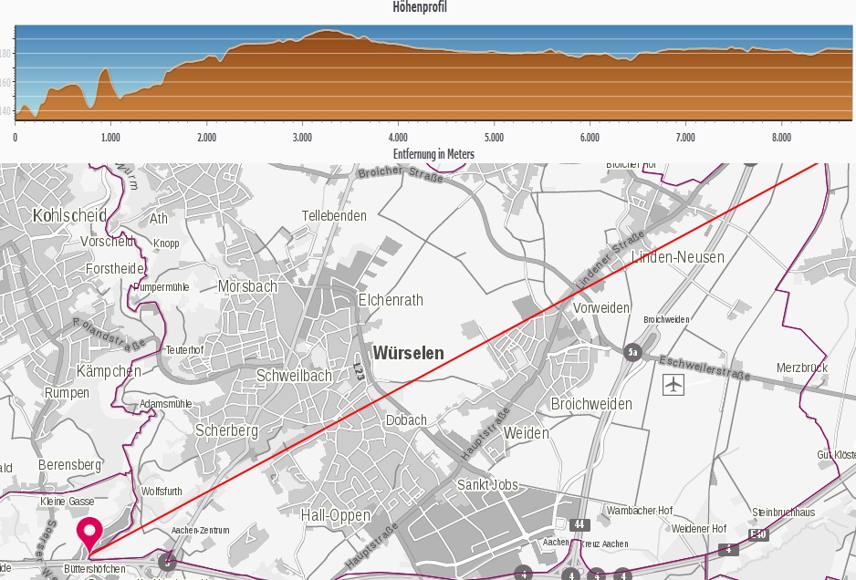
Source: Land NRW (2017) Datenlizenz Deutschland -Namensnennung - Version 2.0 (http://www.govdata.de/dl-de/by-2-0)The profile starts at altitude of 138 m in the valley of the river worm which is not very steep here. It ends at Linden-Neusen, the district at the northeast city limit.
Profile west to east
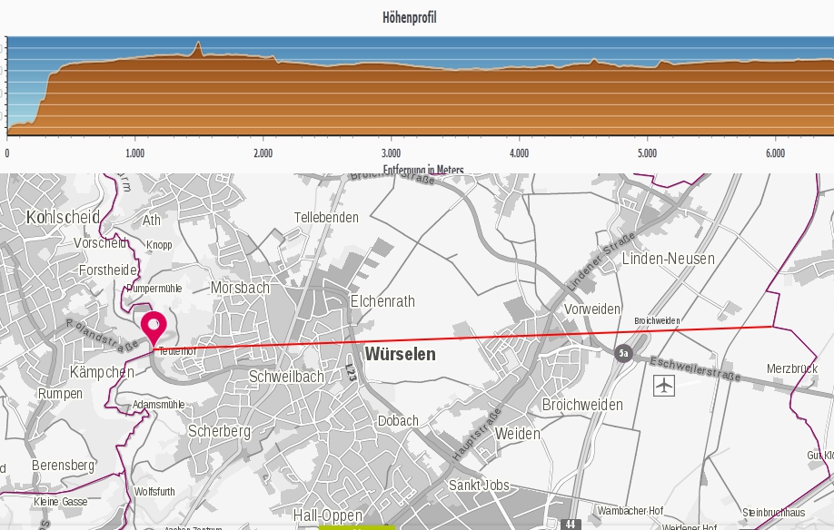
Source: Land NRW (2017) Datenlizenz Deutschland -Namensnennung - Version 2.0 (http://www.govdata.de/dl-de/by-2-0) The profile starts at altitude of 138 m in the valley of the river worm which is steep, ideed. It ends close to the airfield of Merzbrück.
Profile north to south
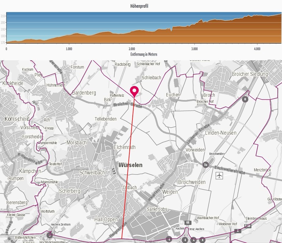
Source: Land NRW (2017) Datenlizenz Deutschland -Namensnennung - Version 2.0 (http://www.govdata.de/dl-de/by-2-0) From north to south the altitude smoothy increase from 170 m in the valley of the Broichbach to 210 m close to the highest altitude you can reach in the city of Würselen.