


")

Once upon a time ...
If you are interested, for example, the names of the boys' games 'Markt-Preck' or 'Dobach-St. Jobs', or why in Bardenberg the Grindelstraße crosses the road Landgraben, then you have come to the right place.
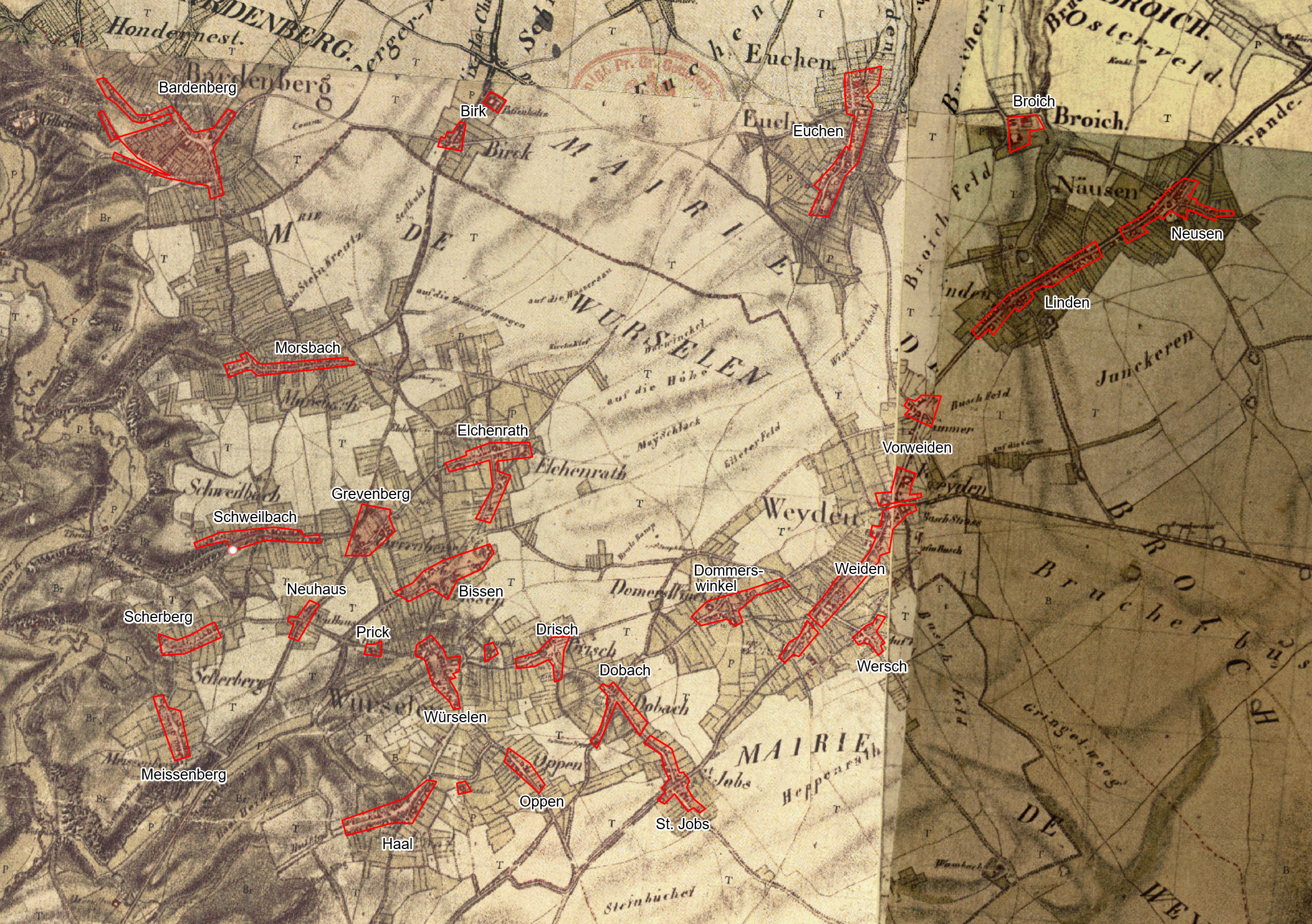
It goes back to the years around 1800. At that time there were the first scale maps of Würselen and the surrounding area. On this tranchot map the germ cells of today's Würselen can be recognized. At that time, the village of Würselen had just 192 inhabitants. Scherberg was much larger and had 316 inhabitants. Even in the village of Haal lived one more, namely 193.
You can't say that the border of the old Aachen Empire ran right through Würselen, but that's not entirely wrong either. On the Trachot map this limit can be seen. And it is digitized here, so that you can transfer the course for a bike ride along the border into your navigation system.
Old maps and new maps on top of each other
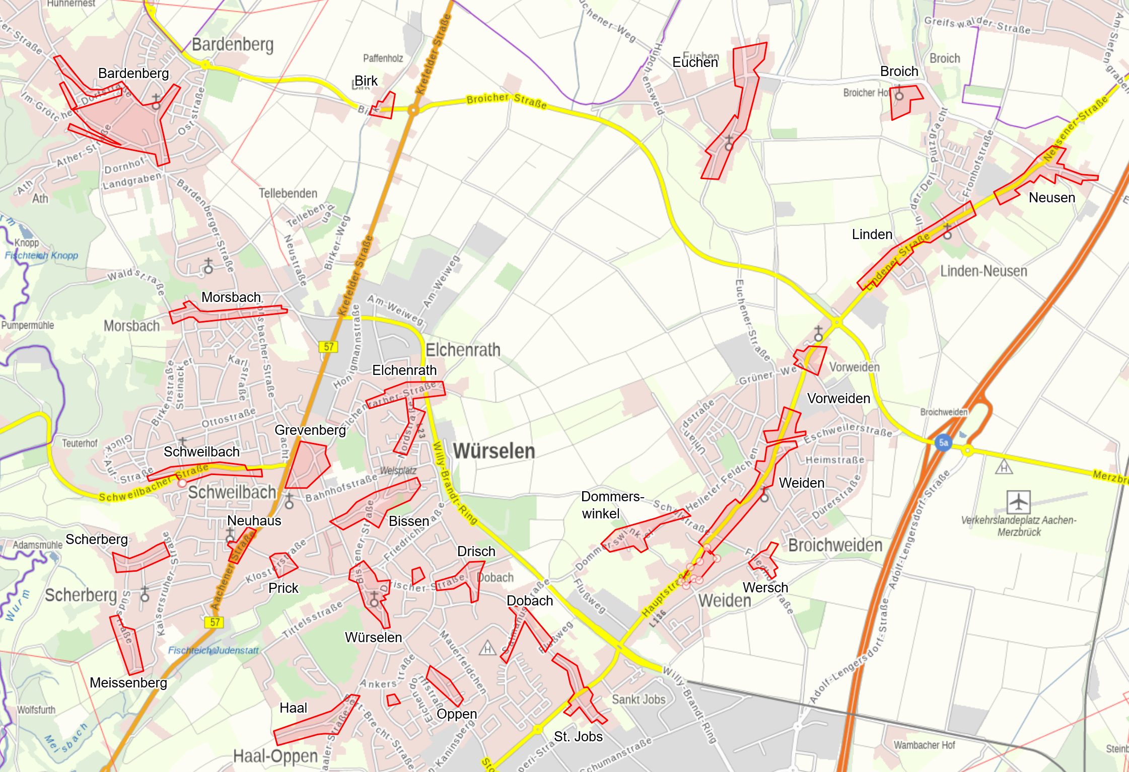
If you like, you can easily view all this in the original in the map portal of NRW, TIM-Online, and put together more maps yourself. At the bottom of the page about TIM-Online, which contains instructions on how to access the maps, you will find a list of routes and predefined map projects. If you are interested in the Würselen of past and present, this is an ideal start.